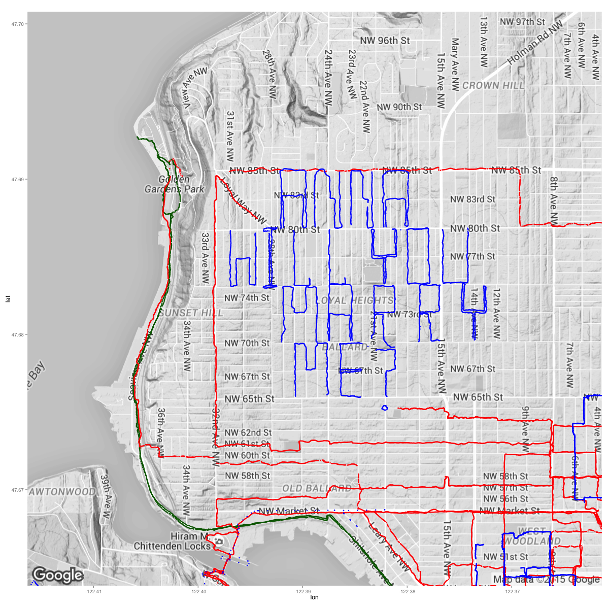
“Loyal Heights” indeed: a GPS engagement proposal
I recently proposed to my longtime girlfriend. I ended up making a 3-part proposal, each supposed to represent a different aspect of our relationship. I’ve been obsessively collecting my GPS movements over the last 9 months to keep track of where I’ve been / interacted with (no car or bus routes, since I don’t really count that as interacting). Since she’s been a part of this hobby (many of the walking routes were done together, and I’ve shown her my progress over time), I figured I’d turn it into one of the parts of my proposal.
Loyal Heights / Ballard turned out to the perfect area for doing this due to its grid layout and vertical alleyways (and unintentionally made for a decent pun). Overall, it seemed like a pretty nice suburban area; I wonder if any of the people there wondered who this strange person was running circles around the neighborhood. It turned into a marathon day (literally — I ended up jogging / walking ~28 miles), but totally worth it for the feeling of appreciation I could give her.
If you’re curious, a zoomed out version of entire map, as well as additional details on how I made it, can be found here.